3D Mapping in Shepparton
Precision you can trust — every point, every detail, every time. We deliver meticulous, end-to-end surveying solutions with complete accuracy and reliability on every project, no matter the scale.
Nature's Symphony
Request a call back
Thank you for contacting Point to Point Surveying.
We will get back to you as soon as possible.
Oops, there was an error sending your message.
Please try again later.
Shepparton 3D Mapping

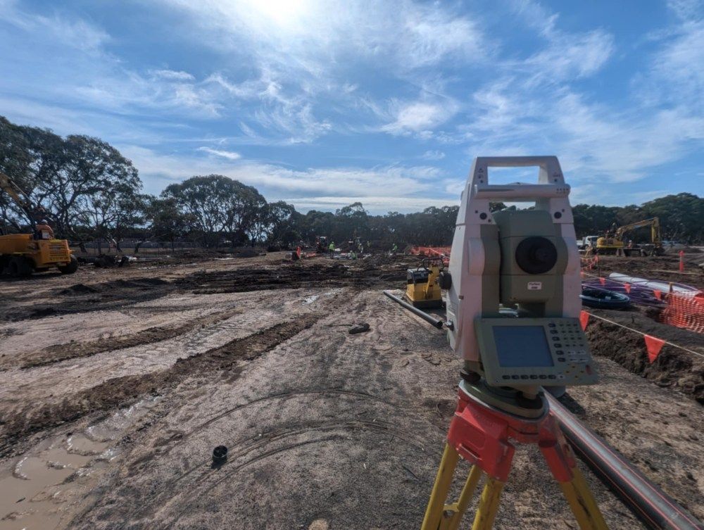
When precision matters, 3D mapping is a game-changer. At Point to Point Surveying, we use advanced 3D scanning and modelling tools to deliver high-resolution site data across Shepparton and nearby regions. Our digital terrain models and topographic outputs provide detailed, real-world visualisations of your site, helping architects, engineers, and project managers make better-informed decisions from the start.
Whether you’re planning earthworks, verifying volumes, or analysing site gradients, our 3D mapping services remove guesswork and increase accuracy. Call 0432 270 722 to find out how we can assist with your next project.
High-resolution digital models for better planning
Supports cut/fill, drainage & volume analysis
Accurate Visualisation for Confident Planning
3D mapping gives you a complete digital representation of your land — ideal for construction planning, infrastructure projects, and progress monitoring. We capture survey-grade data using the latest equipment, then convert it into formats compatible with CAD, BIM, and civil engineering software. This results in easy-to-use models that show contours, structures, surface textures, and elevation changes with precision.
Our team works quickly to minimise site disruption and deliver results you can use right away. From raw topographic data to full surface models, we tailor every 3D mapping job to your project’s requirements. Whether you’re working on subdivisions, industrial builds or roadworks, we’ll provide the spatial insight you need to move forward with confidence.
- Compatible with design software for seamless integration
- Fast turnaround with site data you can trust
FAQ
What is 3D mapping in surveying?
3D mapping in surveying involves collecting spatial data from the physical environment to create a detailed three-dimensional model of the land or site. This process is often used in construction, engineering, mining, and urban planning to visualise terrain, detect elevation changes, and assess site suitability. By using modern instruments like LiDAR, drones, and total stations, surveyors can produce high-accuracy topographic and volumetric data for design, planning, and analysis.
What are the benefits of 3D mapping for construction projects?
3D mapping allows project managers and engineers to visualise land contours, calculate volumes for excavation or fill, and plan site work more effectively. It enhances design precision, improves safety, and reduces errors during construction by providing accurate real-world context. It’s particularly useful for infrastructure projects, subdivisions, and developments where precise ground modelling is essential for decision-making.
How accurate is 3D mapping?
When performed by a professional surveyor using calibrated equipment, 3D mapping can deliver centimetre-level accuracy or better. The accuracy depends on the tools used, site conditions, and the method of data collection (e.g. terrestrial laser scanning vs. drone photogrammetry). A registered surveyor ensures that the mapping output meets industry standards for engineering, design, and compliance purposes.


